What is the bus trip to Machu Picchu like?
The bus trip to Machu Picchu is the final stretch, starting from the town of Aguas Calientes and ending at the entrance gate of the Inca site, following a 10-kilometer route along the Hiram Bingham road.
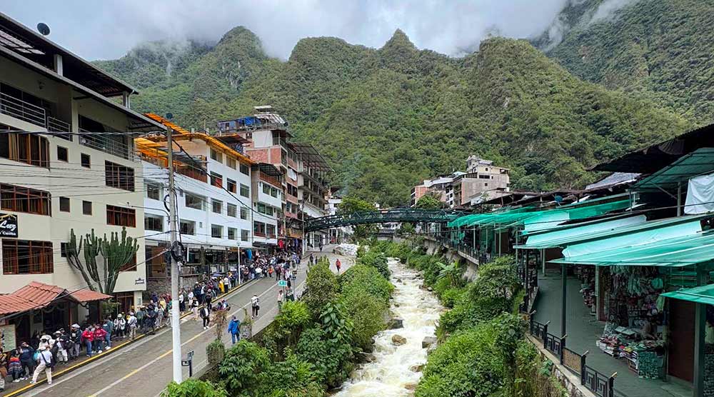
Machu Picchu is located about 10 kilometers from the town of Aguas Calientes. This small Inca town sits at roughly 2,040 meters above sea level, while the Inca site itself is at 2,430 meters. In other words, the bus climbs 10 kilometers up a mountain to a peak nearly 400 meters higher.
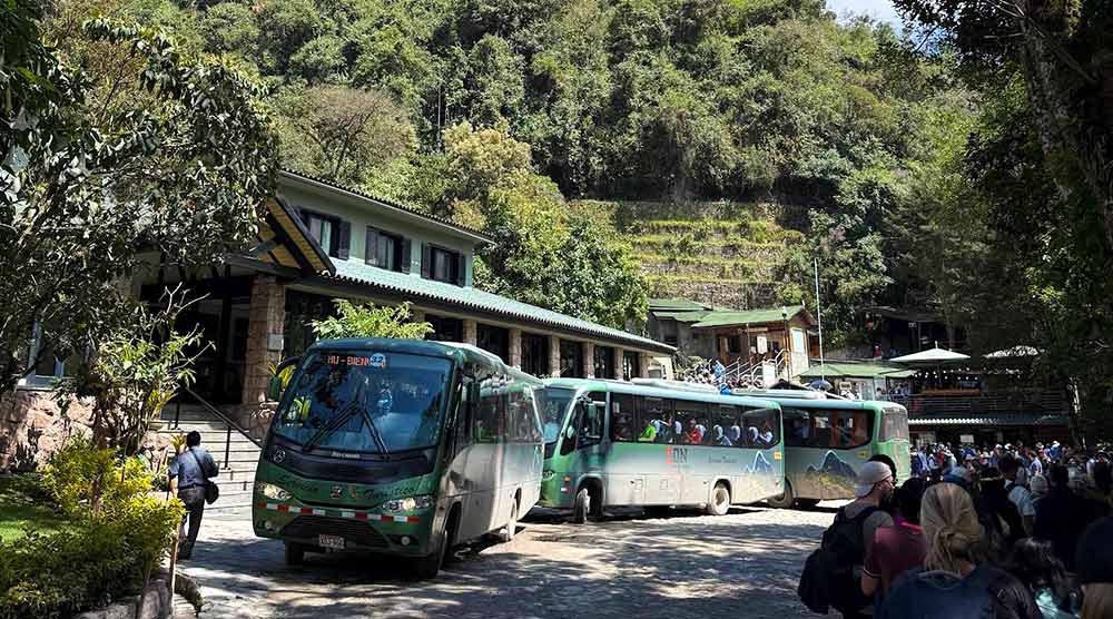
Taking the bus is not mandatory, as tourists can also cover this distance on foot. However, the bus route is extremely comfortable, with spacious seats and panoramic windows. The walking path is challenging. Those who choose to walk will reach Machu Picchu sweaty but accomplished.
The bus route departs from Aguas Calientes on the outbound trip and from the Machu Picchu entrance on the return trip. In both cases, the journey takes around 30 minutes on average. Visitors will enjoy stunning high jungle scenery, with tree-covered mountains, a perfect prelude to seeing Machu Picchu.
The bus trip is a scenic experience filled with beautiful landscapes. Additionally, buses are very comfortable, traveling along winding roads with some bumps. The buses do not pollute the surrounding environment, making them the most comfortable, fast, and pleasant way to reach Machu Picchu, one of the modern Wonders of the World.
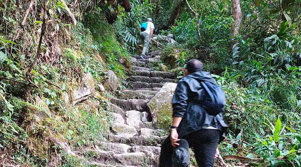
💡 What is the walking route from Aguas Calientes to Machu Picchu? – Taking the bus from Aguas Calientes to Machu Picchu is not the only option, as it can also be done for free on foot. The walk also starts in Aguas Calientes and ends at the Machu Picchu gate, taking about 2 hours on average. The first part follows the Hiram Bingham road up to the Ruinas Bridge. From there, visitors take a stone stairway path that cuts across the bus route. An average visitor can take about 2 hours to complete this route on foot. Seniors or those not in good physical condition may prefer to take the bus.
What is the trip from Aguas Calientes to Machu Picchu like?
The outbound journey follows the Aguas Calientes – Machu Picchu route via the Hiram Bingham road. The trip covers 10 kilometers and takes about 30 minutes, ascending the mountainside. This is the description of the bus trip on the outbound leg.
| Bus Route | Description | Distance |
|---|---|---|
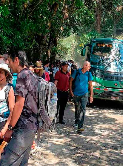
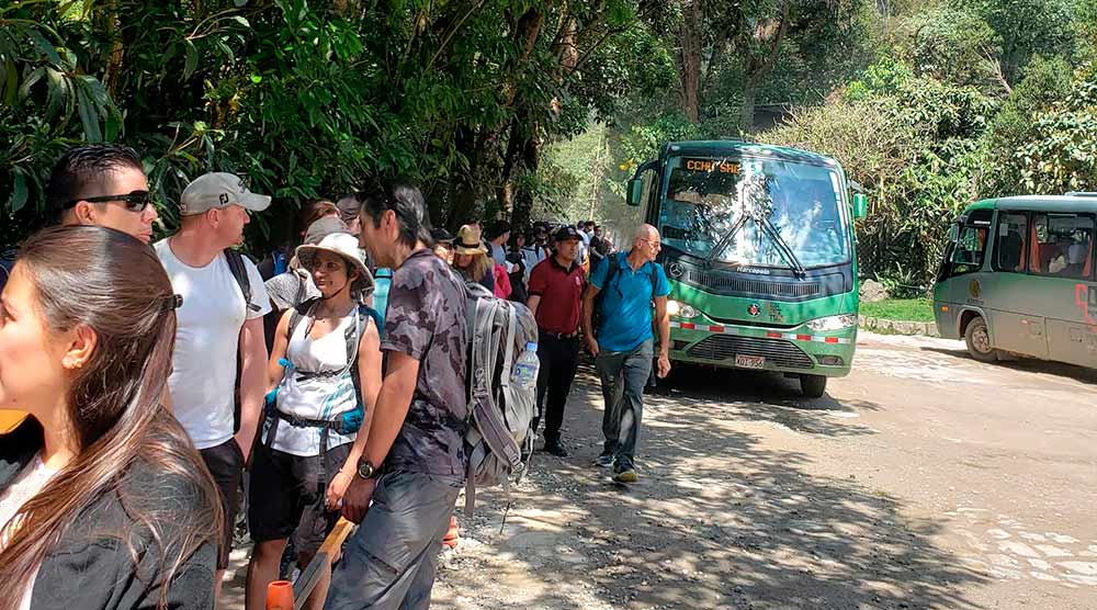
| The queue in Aguas Calientes | Before boarding the bus, queues often form depending on the Machu Picchu visiting schedule. The first group to board are visitors entering Machu Picchu at 6 a.m., who can join the line from 5:15 a.m. During the low tourist season (November to March), the wait is about 5 to 10 minutes. In the high season (April to October), it can take 15 to 20 minutes. The queue forms along Hermanos Ayar Avenue. | During the low tourist season (November to March), the wait is about 5 to 10 minutes. In the high season (April to October), 15 to 20 minutes. |
| The route from Aguas Calientes to Ruinas Bridge | Upon boarding, visitors must show their bus ticket and Machu Picchu entrance ticket. Once seated, the bus travels a short downhill stretch along unpaved roads, almost in a straight line. At Ruinas Bridge, it crosses the Vilcanota River on a smooth, uninterrupted journey. Passengers enjoy views of the Vilcanota River and surrounding high mountains. | From Aguas Calientes to Ruinas Bridge, the bus ride takes about 5 minutes on average. |
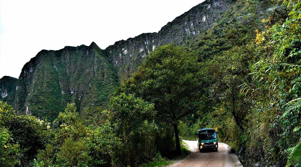
| The route from Ruinas Bridge to the Machu Picchu gate | After crossing Ruinas Bridge, the bus ascends in a zigzag along the mountainside. Visitors can admire lush green mountains, sometimes shrouded in mist, along an unpaved road. The journey adheres to safe speeds, with all seats equipped with seatbelts and wide windows to enjoy the scenery until reaching Machu Picchu’s entrance. | From Ruinas Bridge to the Machu Picchu gate, the bus ride takes about 25 minutes on average. |
And what is the trip from Machu Picchu back to Aguas Calientes like?
The return journey follows the Machu Picchu – Aguas Calientes route via the Hiram Bingham road. The trip covers 10 kilometers and takes about 30 minutes, descending the mountainside. This is the description of the bus trip on the return leg.
| Bus Route | Description | Distance |
|---|---|---|
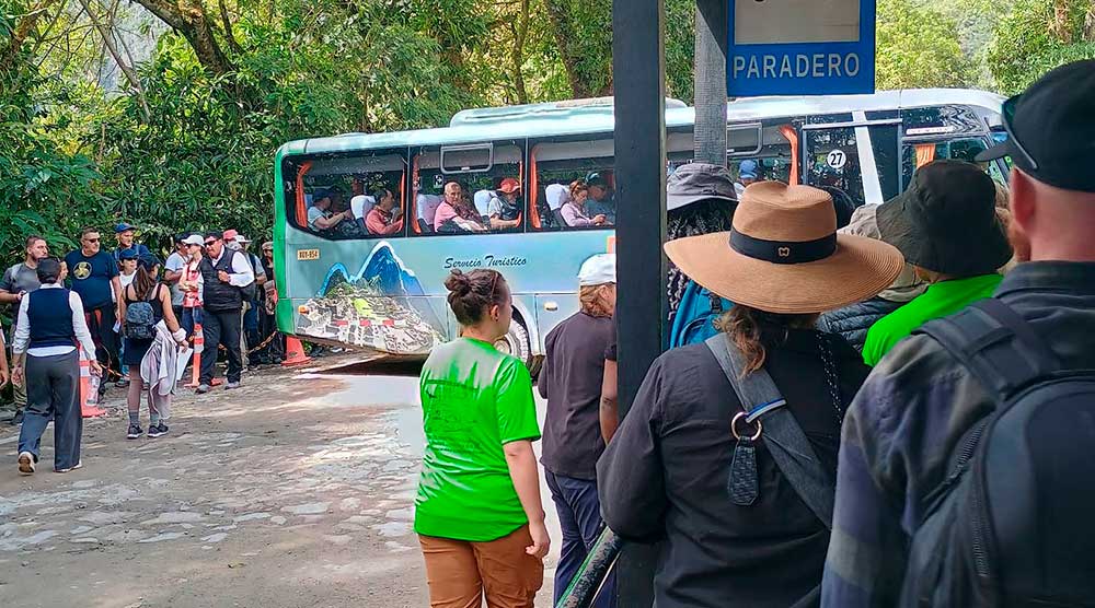
| The queue at Machu Picchu | Before boarding, queues often form, which can be longer between 11 a.m. and 2 p.m., as this is when most visitors leave Machu Picchu. During the low season (November to March), the wait is about 5 to 10 minutes. In the high season (April to October), it takes 15 to 20 minutes. The queue forms right at the site’s exit gate. | During the low season (November to March), the wait is about 5 to 10 minutes. In the high season (April to October), 15 to 20 minutes. |
| The route from Machu Picchu to Ruinas Bridge | Upon boarding, visitors must show their bus ticket and Machu Picchu entrance ticket. Once seated, the bus travels a short downhill stretch along unpaved and winding roads. The scenery is stunning, reminiscent of what was seen at Machu Picchu. Many visitors use this route to relax or review the beautiful photos they took at the Inca city. | From Machu Picchu to Ruinas Bridge, the bus ride takes about 25 minutes on average. |
| The route from Ruinas Bridge to Aguas Calientes | After crossing Ruinas Bridge, the bus ascends almost straight until reaching the town of Aguas Calientes. The route runs parallel to the Vilcanota River and the surrounding high mountains leading to the town. | From Ruinas Bridge to Aguas Calientes, the bus ride takes about 5 minutes on average. |
The Hiram Bingham Road to Machu Picchu
The Hiram Bingham road is the unpaved route that connects the town of Aguas Calientes and the Machu Picchu archaeological site on both the outbound and return trips.
The name honors the American explorer Hiram Bingham, who revealed to the world the existence of the ‘lost city of the Incas’ in 1911.
The road is approximately 10 kilometers long. It was built along the edges of a tall and steep mountain. Maintenance work is carried out every year to ensure visitors can travel safely by bus.
More information about the bus trip to Machu Picchu
The bus trip to Machu Picchu is the final leg of a route starting in the city of Cusco. The most common way to get there is a first car ride from Cusco to the town of Ollantaytambo (1 hour 45 minutes), followed by a train ride from Ollantaytambo to Aguas Calientes (1 hour 45 minutes). Finally, the last stretch is completed by bus from Aguas Calientes to Machu Picchu (30 minutes).
Bus tickets can be purchased in two ways: online via an authorized travel agency website or in person at the ticket offices in Cusco or in the town of Aguas Calientes. Bus tickets are widely available, so no tourist will miss out on a ticket, whether purchased online or in person.
The bus trip is optional. The other way to reach Machu Picchu from Aguas Calientes is on foot. To do this, part of the Hiram Bingham road must be walked from the town to Ruinas Bridge. There, a sign points to the hundreds of stone steps that must be climbed to reach the Machu Picchu entrance. The walking route is approximately 8 kilometers and takes about 2 to 2.5 hours for an average visitor.
Frequently Asked Questions
1. How long does the bus take from Aguas Calientes to Machu Picchu?
The bus trip takes about 30 minutes on average, both for the outbound and return legs.
2. Where is the Aguas Calientes bus station?
The station is located on Hermanos Ayar Avenue s/n, Aguas Calientes town.
3. What is the bus trip from Aguas Calientes to Machu Picchu like?
The bus trip is comfortable, traveling along an unpaved, winding mountain road. It takes about 30 minutes, covering roughly 10 kilometers.
4. How are the queues before taking the final bus to Machu Picchu?
Queues for the bus to Machu Picchu can last between 5 to 20 minutes depending on the tourist season in Cusco.
5. What is the walking route from Aguas Calientes to Machu Picchu like?
The walking route is challenging, with hundreds of stone steps. An average tourist completes it in about 2 hours.
6. How many kilometers are there between Aguas Calientes and Machu Picchu?
Aguas Calientes is 10 kilometers from Machu Picchu via the Hiram Bingham road.
7. What are the buses like from Aguas Calientes to Machu Picchu?
The buses are spacious, modern, and eco-friendly, so they do not harm the environment. All tourists have assigned seats.
8. How often do buses depart from Aguas Calientes to Machu Picchu?
Buses depart every 5 minutes on average.
9. How long does it take to walk from Aguas Calientes to Machu Picchu?
This walking route takes about 2 hours on average.
10. Are buses to Machu Picchu available all day?
Buses run every 5 minutes from 5:30 a.m. to 3:30 p.m. The first Machu Picchu visit starts at 6 a.m., and the last at 4 p.m.